Back to Pasadena to Palm Springs Driving Tour
210E - Duarte and San Gabriel Canyon
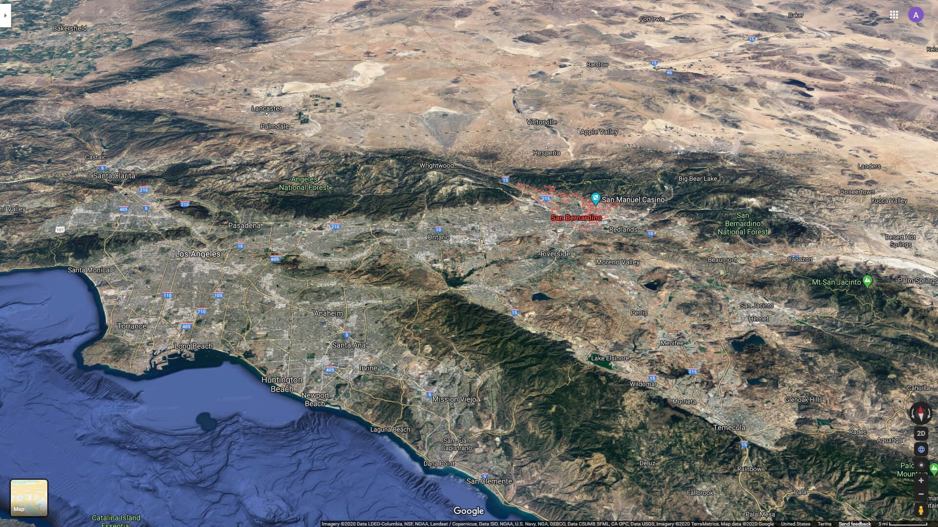
This range to your north as you drive along is comprised of some of the youngest, fastest rising and, most rapidly deteriorating mountains in all the United States. The San Gabriels and eastern cousin, the San Bernardino mountains and the valleys below are the subject matter of our drive today.
Story 2 of 25

Granitic and metasedimentary rocks are the primary constituent of the San Gabriel Mountains. Metasedimentary rocks were attached to the North American craton in the Precambrian eon, and granitic rocks formed throughout the Mesozoic as oceanic plates subducted underneath the North American west coast. Like nearly all of the other mountains in the Transverse Ranges, the San Gabriels are a series of fault blocks that were uplifted in the Cenozoic.[12] Tectonic uplift rates and erosion rates systematically increase as topography steepens eastward in the San Gabriel Mountains, where the San Andreas and San Jacinto faults meet.[13][14]
Current rates of erosion in the eastern San Gabriel mountains are among the fastest in the continental United States[15] and have accelerated in response to the increased frequency of wildfires over the 1900s.[16] Over future centuries, it remains unclear whether soil and brush ecosystems in the San Gabriel mountains will continue to re-establish soil and vegetation after increasing fire and soil-erosion frequencies, or if increasing fire frequencies and erosion will strip soils and permanently alter soil cover and vegetation types across the mountain ecosystem
Duarte has a history much like the entire los angeles and outlying basins. Rooted in cattle ranching under Spanish and Mexican rule once the best places for that lifestyle were identified. Always with sources of fresh water as the natives before them had taken advantage of when selecting their village sites - in this case the reliable San Gabriel river which drained to the sea year around and experienced severe flooding when rainfall amounts stacked up...
ANDRES DUARTE was born at Mission San Juan Capistrano, in Alta California in November 1805. At age 16 he followed his father's career and joined the Mexican army. He was assigned to Mission San Gabriel. Gradually he assumed more responsibility and was finally the major domo, responsible for monitoring the outer lands of the Mission. Transferred to the Mission San Gabriel garrison in his early thirties, he was assigned to protect the Mission property from San Gabriel to San Bernardino. He acquired a deep fondness for the lush green lands surrounding the Rio Azusa, today the San Gabriel River. He grew fond of the area adjacent to the San Gabriel River along the foothills of the mountains, and in 1841, on retirement from military service after 20 years, he petitioned Governor Juan Alvarado for a grant of land that was a vacant portion of the Rancho Azusa. Within two weeks he was granted what was later surveyed to be 6,595 acres! And though he applied as "Citizen" Andres Duarte, the grant immediately made him, now an extensive landowner, "Don" Andres Duarte of the Rancho Azusa de Duarte.
As a condition of the land grant, similar to the provisions of the later Homestead Act, Andres Duarte built an adobe for himself and his family and settled on the land. With the help of local Indians, Duarte planted crops and watched as his flocks and herds multiplied. He and his wife, Gertrudes, and their son, Santiago, lived in a small adobe called “The Homestead” located on what is now Tocino Drive, just east of Royal Oaks Park. He ranched in the conventional manner for years, and like other large landowners, was an outstanding host. After the Mexican-American War and the signing of the Treaty of Guadalupe Hidalgo, his claim to the lands granted in 1841 was validated by the commission appointed by the United States after California entered the Union in 1850. But in the mid-1850's Duarte was unable to pay back taxes levied upon him for his land. He began to sell off his holdings, as his ranching operations failed to raise sufficient cash, a common problem for those who were rich in real estate. The last of his holdings were sold on the auction block. The ranching days of Rancho Azusa de Duarte ended.
The Rancho Azusa de Duarte passed through several hands and was subdivided into 40-acre parcels in the early 1870's. These were sold to many different owners. The most successful were those who planted citrus crops, and soon the Rancho was known particularly for the excellence of its oranges and limes. Duarte remained primarily an agricultural area until after World War II, when it was largely converted into a residential community.
Several cities have been established on lands originally granted to Andres Duarte. The City of Duarte itself was incorporated in 1957. Other cities on the Rancho are Monrovia, Azusa, Irwindale, Baldwin Park, Arcadia and Bradbury. To this day, many of the original boundary lines of the Rancho are traceable as city limits, major streets and the boundaries of hundreds of real estate lots subdivided from larger parcels that were defined by the Rancho boundaries that were formally surveyed in 1858.
Audio Narration
Tour Route
You are here
Experience This Story On Location
Download the History Cake app to experience this story with automatic audio narration as you visit the location.