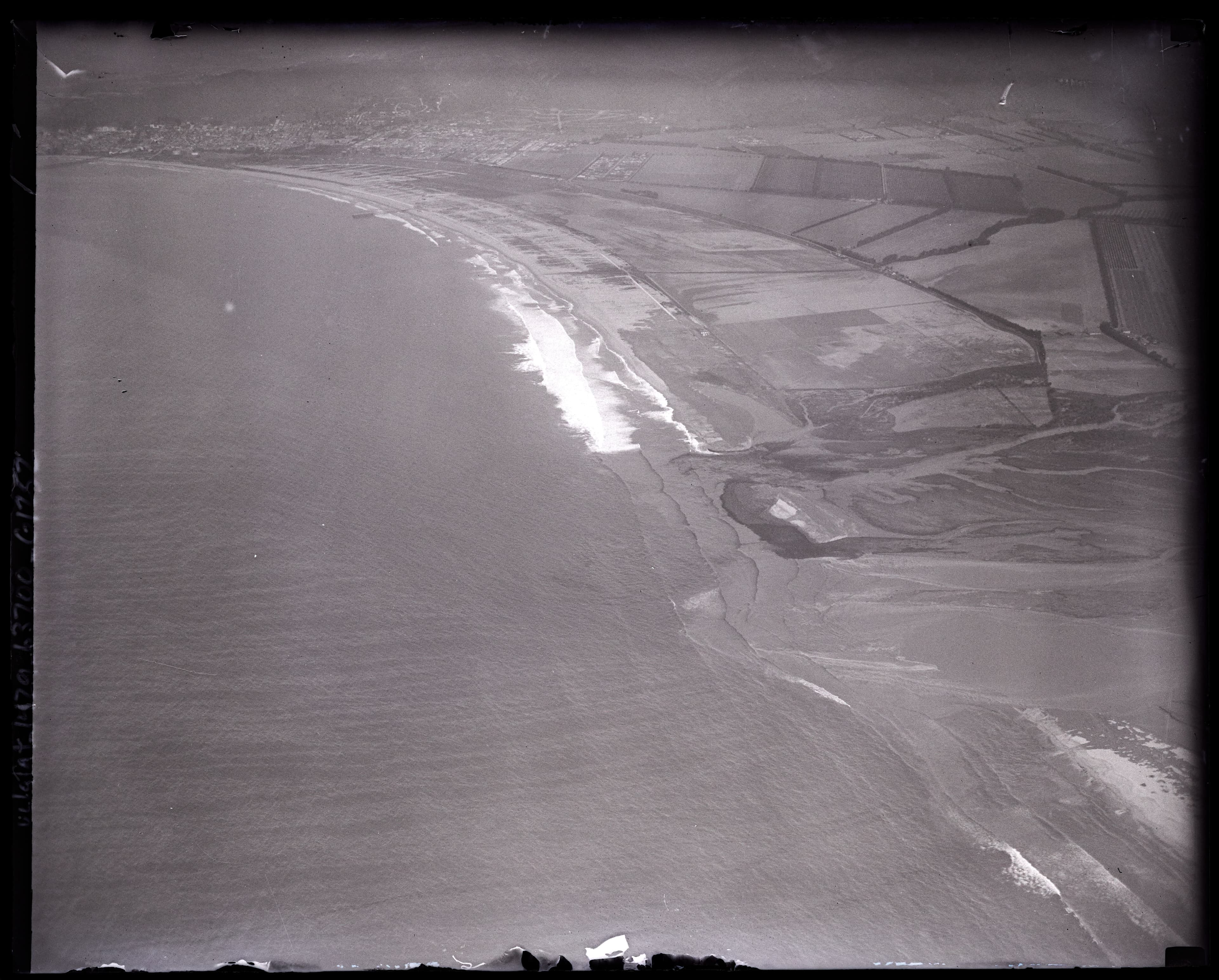
Welcome to HistoryCake, the Saint Francis Dam Disaster tour. From: Saint Francis Dam Disaster Site - 32300 San Francisquito Canyon Rd, Santa Clarita, CA 91390, USA To: Oxnard Harbor where the Santa Clara river meets the Pacific Ocean via the Santa Clara River Valley 126 Highway.
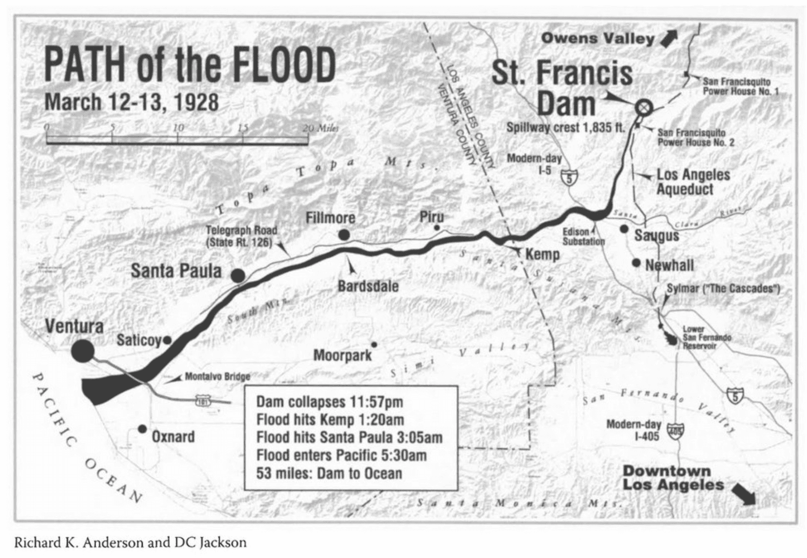
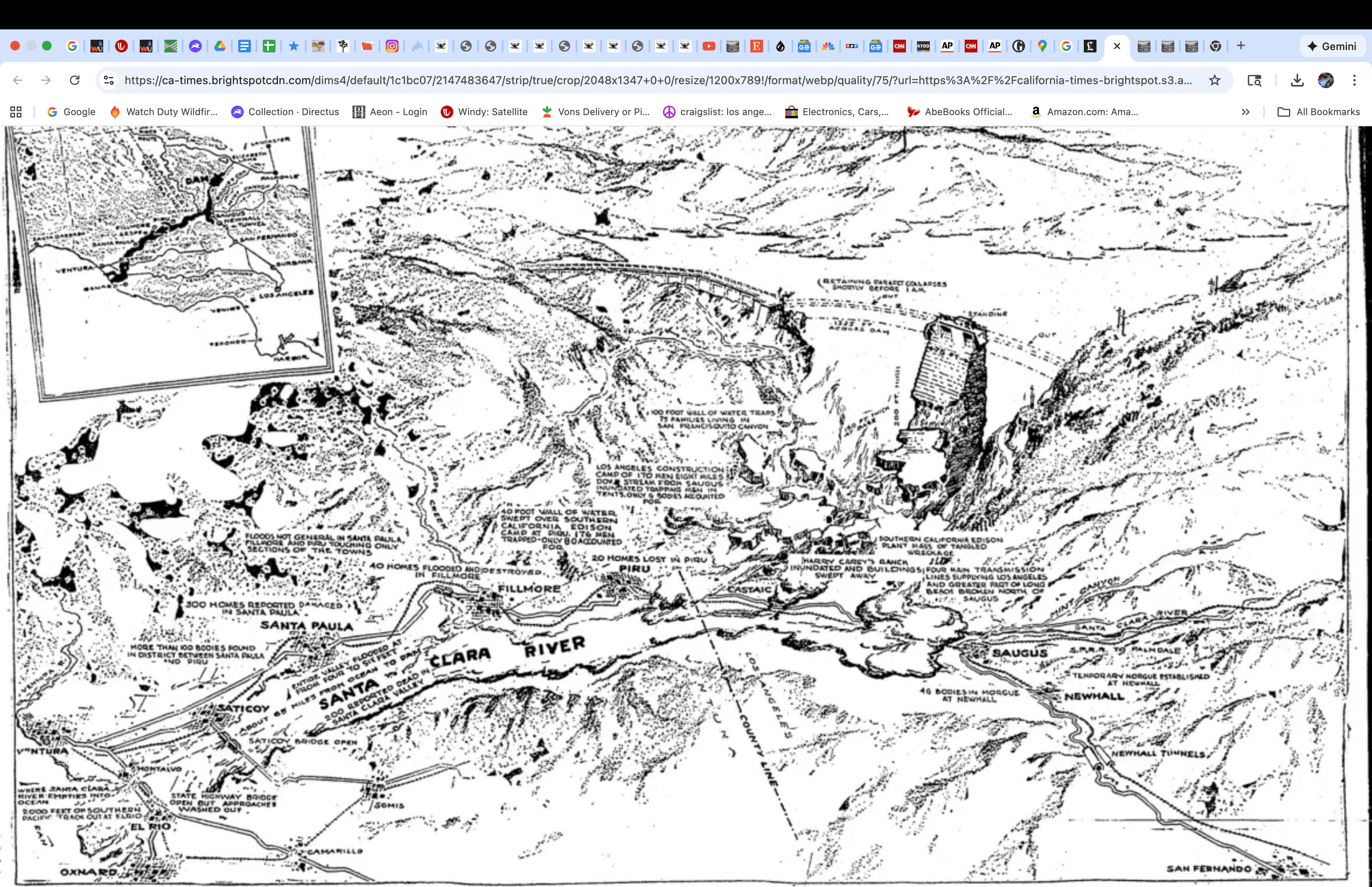
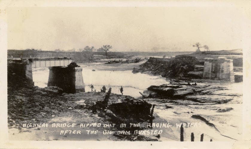
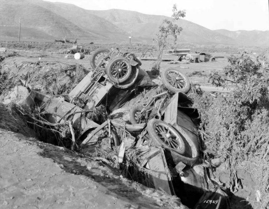
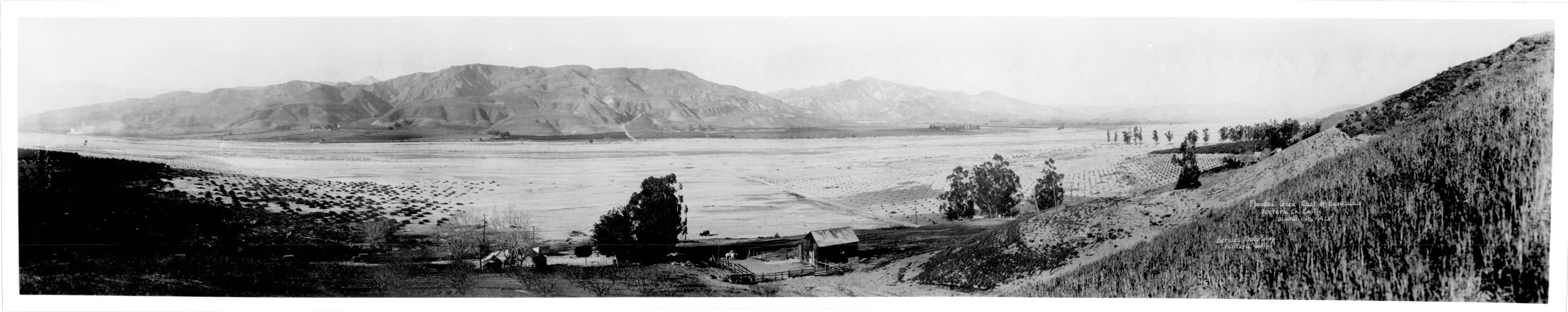
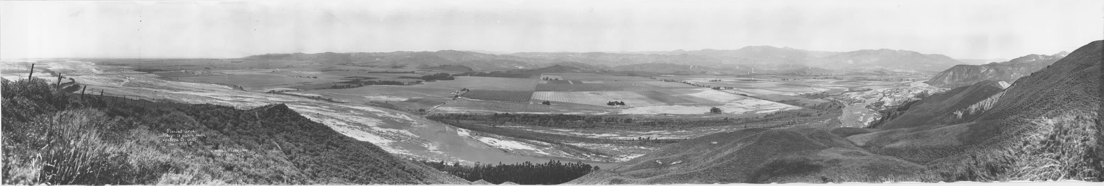
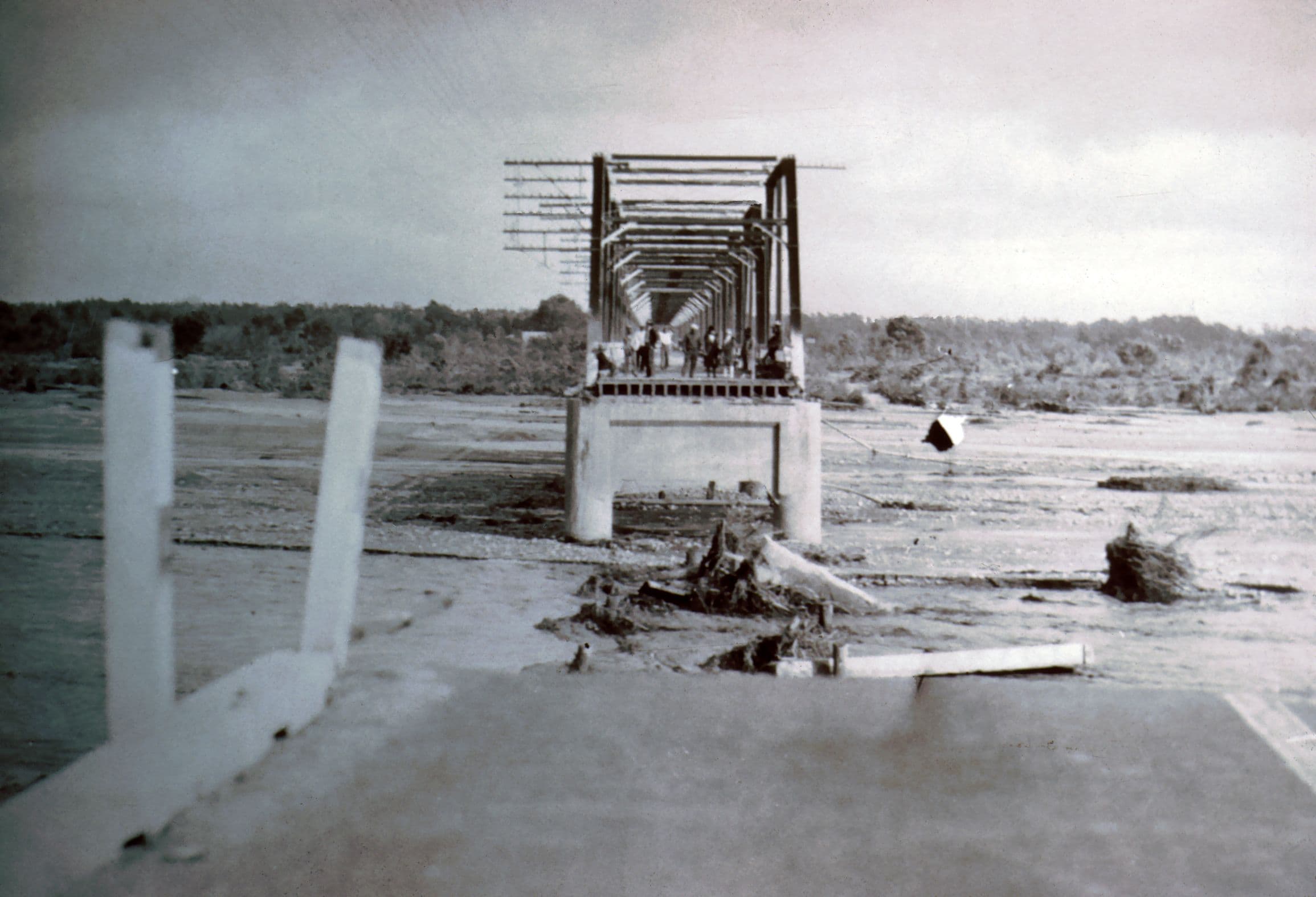
It is a cold March night in 1928 in the Santa Clara River Valley and the San Francisquito Canyon a flood occurred and swept through and took between 400 and 500 lives and loved ones with it.
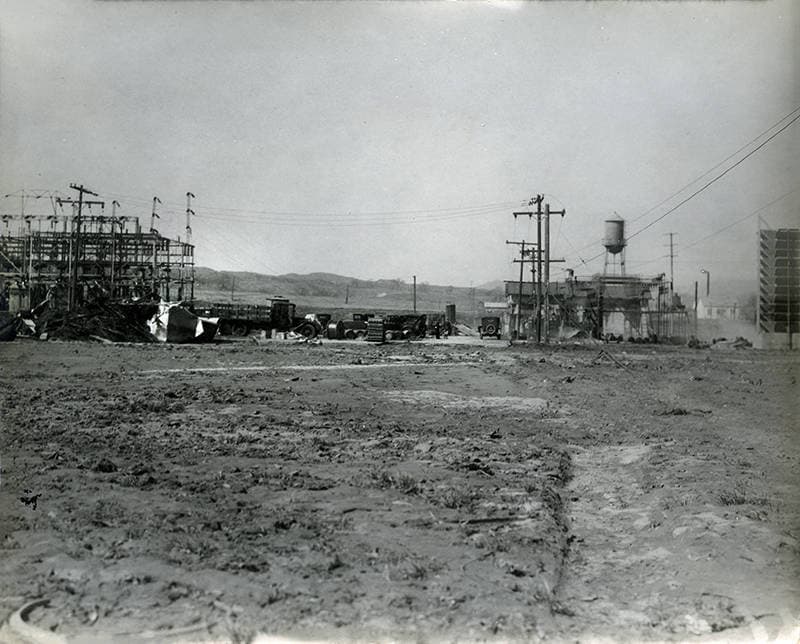
Families and workers deep in their sleep or frantic in escape efforts were fighting an awesome unseen enemy in the frigid morning air. Along with homes and lives, it coldly wipes out the communications and power systems of the day, lines on poles strung along the roads - now rendered impassable.
The northernmost tentacle of the octopus of the county of Los Angeles in the 1920s had its lifelines clipped by a hazard of its own making. The largest man made disaster in the history of California and second only to the San Francisco earthquake and subsequent fire overall was occurring...
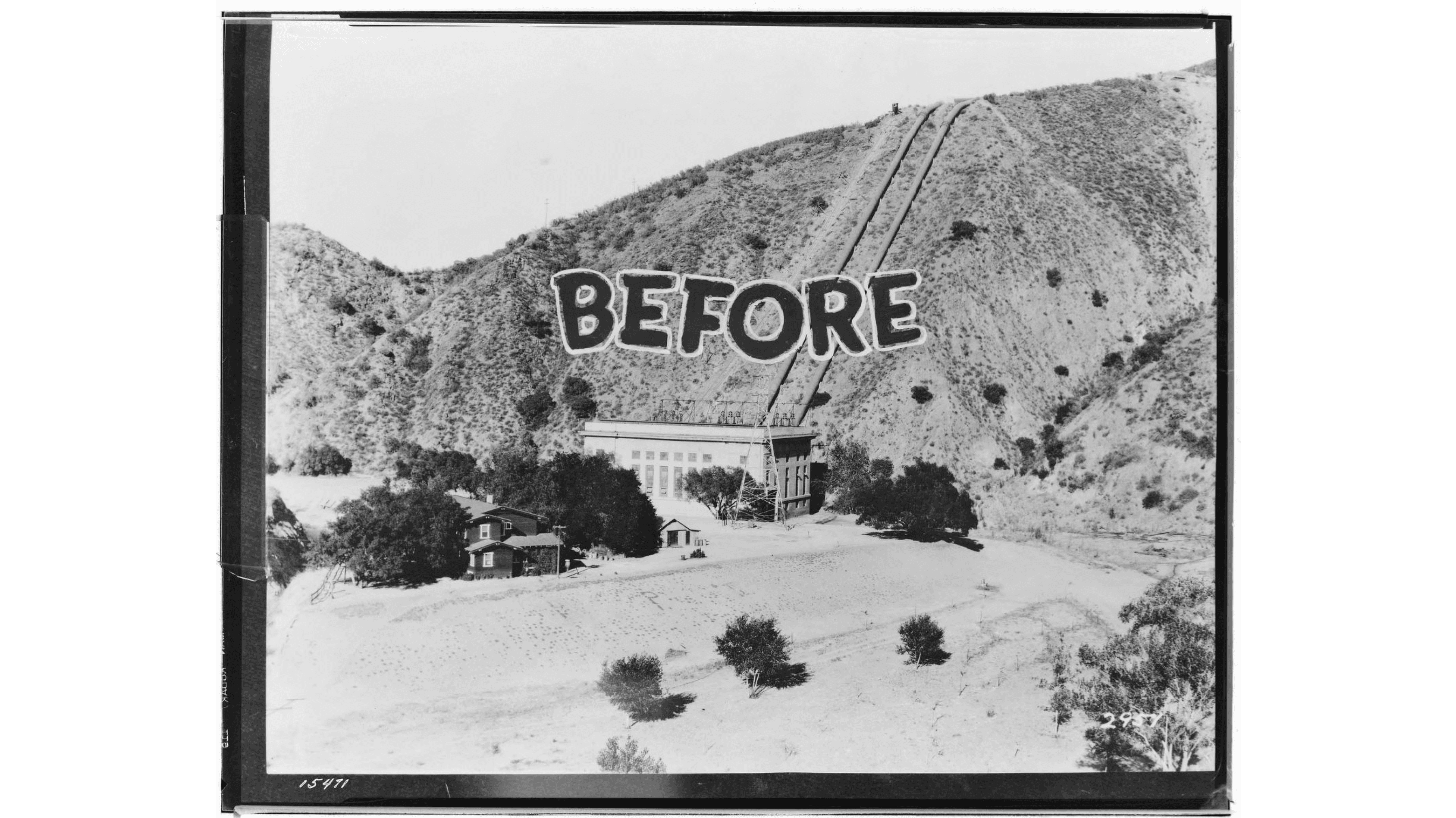
A dam had failed upstream - this St Francis Dam in San Francisquito Canyon was a key piece of the city's drought resistance strategy led by the department of water and power and its chief, William Mulholland. By diverting waters from the Owens Valley and channeling them down to Los Angeles via the aqueduct he oversaw the construction of, they also built reservoirs along the way to store water and generate electricity through controlled release.
As you stand and view the opening photographs and imagine the 14 story wall of concrete in front of, and looming over you, the thought of relocating to higher ground might just creep in as you consider the 14 billion gallons of water just behind it.
Through the eyes of survivors and the deeds of heroes and the terror of those who were not as fortunate, you will hear a story of manmade disaster and the failure of the best efforts of brilliant men trying to contain nature and save now for a string of not so rainy days certain to come again in the future...
It is a tragic and sad and mournful story and it is hard to drive to the beach on the 126 without your mind's eye painting a picture of a night 100 years ago we all wish had never happened.
Download the History Cake app to explore this collection on location. Get automatic audio narration as you travel.
Three Minutes to a March Midnight...
This is the former location of the man charged with inspecting the dam and reporting to the department of water and power on leaks and changes in the clarity of the water creating the leak. He and his son Coder and Leona Johnson, a young lady living with the two of them, were the first to perish in the dam failure as their small cabin was less than a half mile downstream from base of the dam and spillway. It is a cold March evening in the San Francisquito canyon and the few hundred residents living between the dam and the canyon mouth, eleven miles south of the dam face will face a devastating torrent of water and mud and boulders along with barbed wire and fenceposts and tree limbs in the first minutes after the dam's failure.
A 120 foot wall of water ripped the piping and 60 foot tall building completely away and left only the turbines that generated the electricity behind, one of them glowing brightly red after the force of the floodwaters had gone through.
The Ruiz family, who lost 6 family members to the flood, lived between the Powerhouse and the Carey Ranch. The ranch, about 5 miles below the dam, included the Carey's wooden home as well as several outbuildings and the Harry Carey Trading Post, which was a tourist attraction that included billed entertainment from Navajo Indians and other performers, along with a store that sold Western and Indian curios. About 30 minutes after the collapse, the Ruiz and Carey ranches were inundated by a 55 foot wall of water and boulders and debris. The trading post washed away in the St. Francis Dam disaster of March 1928 and was not rebuilt.
What began as a 150 foot wall of water had subsided to 55 feet of mud, boulders and debris when the flood roared out of San Francisquito canyon toward a sleepy Saugus, then a small town of perhaps a couple hundred souls. Several small buildings at the substation were destroyed, among them some of the Edison workers' cottages, as "a thick layer of sand, gravel and debris ... pushed south over the Santa Clara River channel" (Hundley & Jackson 2015:144). The substation was inundated and the transformer yard was littered with debris
12:55 AM on March 13th and 58 minutes after dam failure a 40 foot wave of water moving at 12 miles per hour and full of mud, barbed wire and debris of ranches and farms upstream, demolished the steel truss bridge at Castaic Junction. Two large railroad bridges and the main highway across the Santa Clara riverbed were lost in a matter of seconds in the deluge.
The flood roared down from Castaic Junction toward Del Valle in the Santa Clara River Valley. The flood wiped out Joe Gottardi's Pecan orchards as well as his Blue Cut field. His home, wife and daughter were all taken from him by the floodwaters. All 1720 acres of his agricultural and livestock land were totally destroyed by the thirty foot wall of mud, boulders and debris. Some 150 Edison linemen had been stringing a power line from Saticoy to Saugus, Nichols writes. They were camped on the opposite bank of the dry Santa Clara River bed from Blue Cut, an outcropping of bedrock just east of the L.A.-Ventura County line. The floodwaters lashed against the rock and whipped back over the drowsy workers who'd been asleep in their tents, dealing them a double dose of disaster. Eighty-four perished.
Setting for Ramona - Helen Hunt Jackson and mistreatment of native population by mission system and rancho system. Largely spared from the flood because it sits on a small plateau, the slight elevation of which allowed the farmhouse and adjacent buildings to survive the 15 foot flood in the riverbed just below them.
Largely spared due to its elevation, it, like rancho camulos, was used as a first aid and temporary relief station for the victims of the flood disaster. Its cemetery holds the remains of the Gottardi family children and their mother with only the father surviving the deluge as it struck his orchard and farmhouse east of the Kemp siding where over 80 Edison workers lost their lives that cold, early morning in 1928. The flood destroyed 20 homes in Piru but no recorded deaths.
Iron truss bridge spanned the santa clara river connecting the two communities. After warnings, people standing on the bridge finally retreated before it collapsed in a heap of twisted metal. Nearly 3 thousand people live in the area when the flood of 12 feet roars through - two and a half hours after the dam failed 31 miles upstream.
Santa Paula had a population of about four thousand inhabitants when the flood rushed through at 3:05 on March 13th. Many lives were saved in Santa Paula due to the early warning provided by patrolmen Thornton Edwards and his brave motorcycle ride up and down the streets of the town and then outlying areas until the flood was upon him. Unfortunately, 11 souls were lost on that cold morning and 300 families were without their homes by 4 AM.
By the time the flood gets to Saticoy, like (Montalvo, a small farming community mixed with workers and single family orchards) - it has widened to over a mile and a half and is between 4 and 6 feet high and chock full of upstream ranch and orchard debris.
Montalvo is one of the last towns impacted by the disaster before the flood washes out to sea.
The ocean is turned a murky brown for miles up and down the coast as the floodwaters leave the riverbed and enter the Pacific. Bodies are washed out to sea and found days later, some as far away as San Diego. Many lives were lost and many others were saved and like all crises, there is a uniting and setting aside of past differences.